Protecting Our Watershed
A Watershed Checkup Report
![]()
Protecting Our Watershed
A Watershed Checkup Report
|
How do we measure watershed health? There are four primary indicators that we will measure within the Watershed Checkup framework to determine our overall health. They are forests, wetlands, surface water and groundwater. CLOCA is responsible for monitoring watershed conditions throughout our jurisdiction, targeting these specific environmental indicators. Quality and quantity of surface water, groundwater, forest cover and interior forest habitat conditions, riparian and wetland cover will be used to help us assess the health of our watersheds today, and provide a point of reference for future comparisons.
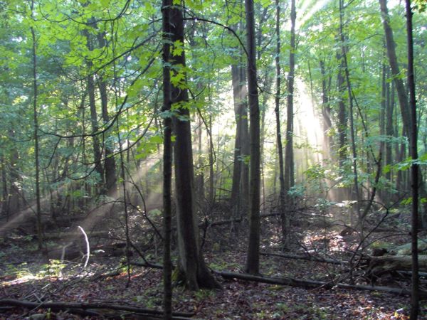
We know that trees clean our air and water, prevent erosion, reduce flooding and provide important habitat for wildlife. From our own observations and extensive research by others, the more forested a watershed is, the healthier it will be and the higher the grade.
A wetland is a place where land and water come together. Wetlands can be a swamp, a marsh, a bog or a fen, deriving this classification from the type of plant life they host. All wetlands whether a treed swamp or a cattail marsh provide us with a host of services like improving water quality, reducing erosion and flooding and providing habitat for terrestrial (land) and aquatic(water) species.
As water travels over land, it picks up contaminants like salt and oil from our roadways and fertilizer or pesticide from our lawns. The aquatic organisms that live within our creeks, ponds and wetlands that receive this polluted water, are sensitive to the resulting changing conditions. By their presence or absence, they tell us a lot about the quality and health of that water and where we can make improvements.
Surprise! Not all water travels over land. A great deal of it is absorbed by the ground trapping rain and snow and releasing it slowly, back into our creeks and wells, cleaning it and contributing to a reduced risk of flooding and erosion. It acts like a giant reservoir and large pockets of water under the ground are appropriately called aquifers. But even under the ground, covered by sand, gravel, rock and soil, it can be polluted. This not only presents huge risks to rural communities that rely on water from their wells for drinking, but that same water eventually makes its way downstream as surface water. It may end up in a creek where you fish or in
For more information on the Central Lake Ontario Conservation Watershed Checkup, please contact: Patricia Lowe, BLA, OALA, CSLA |
 Our Forests
 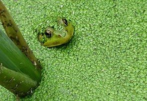 Our Wetlands
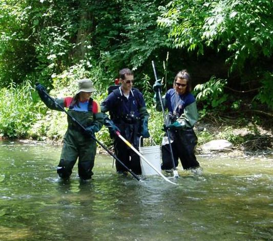 Our Surface Water
 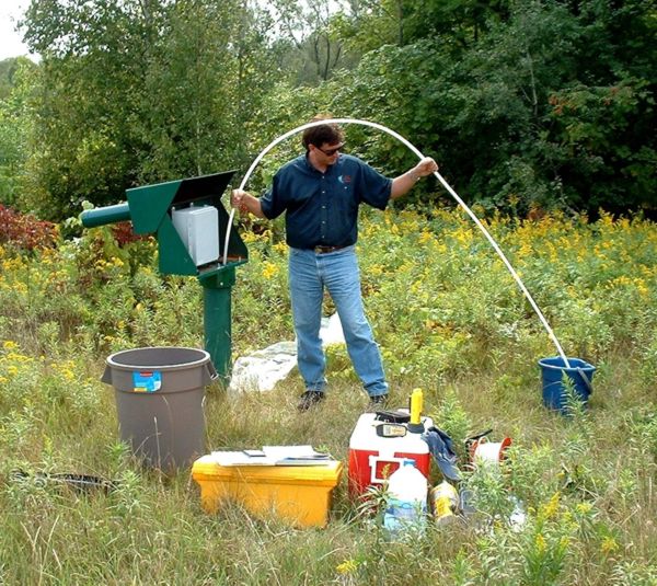 Our Groundwater